Key information
Duration: 3 years full time
UCAS code: L711
Institution code: R72
Campus: Egham
The course
Geography, Geopolitics and Global Affairs (BA)
Geography engages with some of the most must fundamental challenges facing the modern world, as well as opening up critical questions about our past, presents and futures. Study Geography at Royal Holloway and you’ll join a leading centre for geographical research and teaching, where academic staff are advancing understanding of the challenges facing contemporary culture, the economy and environment.
BA Geography, Geopolitics and Global Affairs examines the social, political and economic aspects of geography. There has never been a more important time to respond to the world’s challenges as a global society, requiring new thinking that cuts across traditional boundaries, political behaviours and processes.
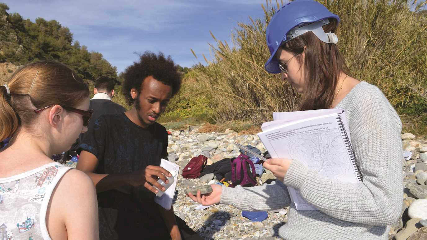
You’ll benefit from world-class, research-led teaching in a Department ranked 5th in the UK for research by the Research Excellence Framework 2021. Fieldwork is a key part of the experience of doing Geography at Royal Holloway. As well as being excellent research training, our extensive programme of fieldwork helps bring the department together as a real community. The department offers a substantial and exciting range of field trips in the UK and overseas. Current locations include Cyprus, Spain, Malawi, Sicily, London and New York.
This flexible course gives you the chance to tailor your studies with a range of optional modules in years 2 and 3, to suit your interests and career ambitions. You’ll gain a range of skills and knowledge to take into your future career, making you a highly employable candidate in a number of sectors.
From time to time, we make changes to our courses to improve the student and learning experience. If we make a significant change to your chosen course, we’ll let you know as soon as possible.
Course structure
Core Modules
Year 1
-
In this module you will develop and understanding of the factors that control the physical, biological and chemical forces which shape the Earth’s surface. You will look at oceanic and atmospheric processes, plate tectonics, hydrology and coastal processes, glaciation, and arid environments.
-
In this module you will develop an understanding the complexity of the relationship between people and environment. You will examine how and why ecosystems vary spatially and the impact of human activity, such as deforestation and agriculture, on the physical environment. You will also consider the nature of environmental change, including climatology.
-
In this module you will engage with key issues in human geography. You will consider human geography as a distinctive way to approach the world, examining key questions about globalisation, inequality, identity and the nature of place. You will look at approaches to economic, cultural and historical geography, and the development of the discipline, celebrating geographers’ active involvement in the challenges facing humanity.
-
This module will introduce you to human geographical perspectives on political processes, societies, development and the environment. You will develop an appreciation of the importance of scale, networks and spatial patterns, and how geographers have approached the challenges of inequality at local, national and global scales.
-
This module will provide you with an introduction to the methods for collecting, interpreting and presenting physical and human geographical information, in both the field and in the laboratory. You will conduct physical and human geography fieldwork in the local area, with activities including surveying and mapping, vegetation sampling and identification, soil and water analysis, interpreting past history, exploratory and inferential data analysis, questionnaire design, interviewing, and visual and textual interpretation.
-
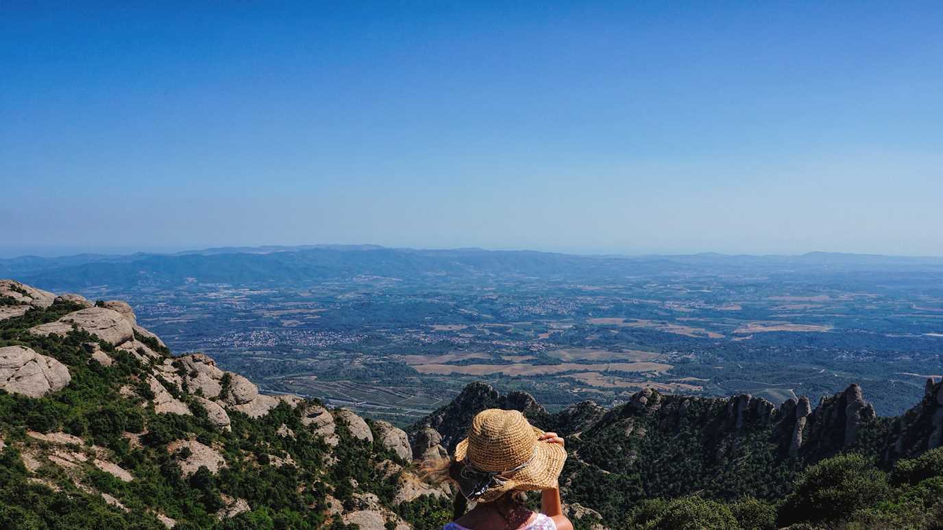
In this module you will develop your practical research skills on a week-long field-trip to Andalusia in Southern Spain. You will spend four days, guided by staff, looking at specific local examples of physical, environmental, social, economic and cultural processes. You will then spend two days, working in small groups, conducting a short piece of original research on a topic of your choice.
-
This module will provide you with an introduction to the use of Geographical Information Systems (GIS) in physical and human geographical research, giving you practical experience in the use of ArcMap (an industry-leading GIS software package). You will look at the use of satellite remote sensing for geomorphological mapping, census classifications and boundaries, and volunteered geographic information.
Year 2
-
In this module you will develop your skills in research design, data collection and analysis. You will learn how to handle and process advanced human or physical geography data sets, and further your ability to apply geographical information systems (GIS) techniques. You will also start to plan your dissertation, thinking about proposal design, and risk and research ethics assessments.
-
This is an intermediate-level module which develops skills and abilities introduced in GG1011 Geographical Techniques and GG1032 Geographical Field Research and Techniques. GG2006 specifically: (i) provides students with training in research design and research management in a field situation; (ii) develops students’ skills in a variety of field-based research techniques; (iii) provides advice and experience in preparation for the completion of independent dissertations (GG3003); (iv) provides experience of specialist research in the field in relation to geopolitics and/ or development.
-
This module introduces key concepts and ideas in political geography and geopolitics promoting an appreciation of the relationship between politics and geography through a range of different theoretical lenses, a series of diverse contexts, and at a variety of scales. Each term, the lectures will be broken down into several key components beginning with an introductory lecture, tracing the emergence of political geography. Both terms 1 and 2 will then proceed with a series of ‘lens’ lectures, introducing students to a range of theoretical lenses and analytical frameworks through which to engage and analyse contemporary and historic geopolitical issues. These lenses include: objects, feminist geopolitics, popular geopolitics (taking place through an interactive workshop), infrastructures, mobilities, and technologies. The course then moves on to a series of ‘context and theme’ lectures, which will provide students with an opportunity to apply the lenses to key thematic areas and contexts within contemporary political geography.
-
This module develops within students concern, critical awareness and informed concern for ‘distant strangers’ and other cultures, linked to the notion of responsibility in an unequal and interconnected world. The course addresses theories, paradigms and critiques of development; the environment-development interface and sustainability, the changing international economic and political order; the roles of state and non-state actors such as NGOs and; trade and aid policies. Processes, causes and consequences are explored with reference to spatial variations, differences and inequalities, and their implications for different places and at different geographical scales, highlighting the complex nature of interdependences. Explicit attention is devoted to the historicity and contextuality of changing perspectives on development as process and problematique. This in turn provides insights into the nature and philosophies of the disciplines of geography and development studies.
Year 3
- All modules are optional
Optional Modules
There are a number of optional course modules available during your degree studies. The following is a selection of optional course modules that are likely to be available. Please note that although the College will keep changes to a minimum, new modules may be offered or existing modules may be withdrawn, for example, in response to a change in staff. Applicants will be informed if any significant changes need to be made.
Year 1
-
All modules are core
Year 2
-
This module focuses on the use and management of resources, in the context of inputs and outputs to environmental systems, with an emphasis on processes and the impacts of human activities. Throughout the course, students gain hands-on experience through practical work relating to the processes, functioning and management of environmental systems in the context of sustainability. These practical elements form the basis of the formal assessment. Students develop an understanding of resource use and waste impacts at a range of levels, particularly global, regional and local, and over a range of time scales, investigating ideas of direct impact and environmental storage of materials. This material will be taught with links to physical processes, but will inevitably include links between human exploitation of environments and environmental impacts.
-
This module focuses on two overall themes: 1) the earth surface processes responsible for shaping the physical landscape and 2) natural hazards, where extreme earth surface process events pose a societal risk. The course is centred on the following key geomorphological systems: slopes, rivers, glaciers and dunes. Key hazards covered relating to these systems include landslides, floods, glacier lake outburst floods and dust storms. The module concludes with consideration of how plate tectonics and earth surface processes operating over millions of years shape landscape evolution.
-
This module develops an appreciation of the historical context which underpins theory concerning environmental history, present-day environmental problems, and the prediction of future environmental changes. Practical training in laboratory methods relevant to testing such theories is involved, and you will train for readiness to undertake fieldwork and third-year independent studies (dissertations) in a range of topical research themes in Quaternary environmental change. Laboratory practicals are designed to give experience in using a number of fundamental methods used in the analysis of stratigraphical records, which underpin the reconstruction of former environmental conditions. The accent is on the careful observation and logging of data, and on precision and accuracy in description and analysis of the processes leading to rapid environmental change. Training is provided in data presentation and in the construction of scientific reports, as well as other key skills in the field of quaternary Science, such as the use of electronic resources and bespoke software packages for bibliographic searching, inspection of large databases of relevant palaeoenvironmental information and practical approaches such as radiocarbon calibration.
-
This module will provide a sound theoretical and historical background to biogeographical research and the basis of biodiversity. The main themes to be explored are: dispersal strategies of organisms; the principal factors limiting species distribution at the present day (climate drivers, vegetation, physical barriers, competition and niche-specialisation, predation and parasitism); geographical centres for origination and dispersal, including coverage of plate tectonics and land bridges; natural selection and evolution; the role of past and present ecosystems; island biogeography; the Quaternary histories of different groups of flora and vertebrate and invertebrate fauna; natural and anthropogenic threats to ecosystems; extinction and the effects of disease.
-
This module introduces the concepts and theories used to interpret and explain urbanisation and urban processes, providing critical knowledge of urban political economy, urban political ecology and urban social movements. It refuses a neat division of the social and the natural by equipping students with critical tools to analyse the ecological transformations implied by political economic shifts and contested by urban social movements. This module emphasises the importance of spatial variations in a globalising world; how spatial relations are an inherent and important feature of economic, social, and political activity; how particular places and environments are constituted, contested and remade; the significance of spatial and temporal scale on urban processes; and the development of an appreciation of change in urban systems, providing insights into the nature and philosophies of the discipline of geography.
-
This module is concerned with the character of place and culture in the modern world. It explores both the material cultural transformations wrought by processes of modernisation and how people understand and imagine the places, spaces, times and environments they inhabit. More specifically, the module addresses issues of global geographies of cultural change, especially the relationship between the local and the global; questions of place, identity and landscape, especially at the local scale; the significance of place and space in the invention of modern traditions, including places of memory (memorials, museums), symbolic national landscapes, and post-modern urban design; and nature-society relations. The module addresses ways of representing and interpreting the world; spatial relations and systems linking spaces at a variety of scales; patterns of change in the development of the modern world; the production of differences in society and place; the changing place of cultural geography within the discipline as a whole.
Year 3
-
This module reflects the changing face of coastal and shoreline management, linking coastal functioning with the impacts of human activity on the coast. It is suitable for both physical geographers, and human geographers with an interest in the interface between human activity and the physical environment.
-
This module looks at the determinants of tropical savanna form and function; the importance of the woody/grass mosaic in tropical savannas; the role of fire in tropical savannas; herbivory in tropical savannas; dynamics and environmental change in savannas; land use in tropical savannas; management issues affecting present-day savannas, decision support systems for savanna management; and the future outlook for tropical savannas. Students will look at the interactions between the physical and human aspects of savanna environments and landscapes, the importance of spatial variation and scale in these interactions; the nature of savanna patterns, processes and interactions as systems; short- and long-term change in tropical savannas; analytical and observational strategies for studying savanna functions and impacts and their analysis; the contribution of the discipline of Geography to the understanding of tropical savannas, and as a basis for informed concern about the ecosystem and its people.
-
This module aims to provide a detailed discussion of the science behind global warming. In particular, we will focus on three main themes. Firstly, how do we know that global warming is really occurring and how do we know that it is down to us? The first part is, therefore, a series of debates that address the main issues that are proposed by climate sceptics and present the scientific arguments that may refute them. These lectures cover issues such as; 1) how do we distinguish between “natural” and “human” climate changes, 2) when did humans start to influence the climate system and how do we know, and 3) how are key global warming datasets, such as the “Hockey Stick curve” generated and what are the assumptions that it is based upon. The second part will look at the prediction of climate change. What are the current predictions for future warming? What are they based upon and how robust are they? Finally, we will deal with the impacts of this global warming on different components of the Earth system, namely the cryosphere (ice sheet collapse and sea level change), extreme weather events (such as hurricanes), ecosystems (desertification etc) and the response of different parts of Europe to changing temperature and rainfall regimes.
-
This module covers the range of human impacts on the river environment and the range of strategies which have been developed to manage contemporary river channel change. Principles of flood hazard evaluation, flood forecasting and flood defence are also a major theme. The evolution of river channel management in recent years has been radical. The ‘techno-fix’ hard engineering approach has been seen to involve unforeseen channel changes involving progressive impacts upstream and downstream. Such changes have then required unsustainable further management interventions. The problem has been that engineering interventions have often not been in sympathy with the natural balance of river processes. Recently therefore, geomorphologists and river managers have explored strategies of ‘working with the river’. This has led to the increasing importance of ‘river restoration’. The module will cover this debate and the principles of river restoration using seminars and case studies.
-
This module provides a detailed critical assessment of modern and Quaternary glacial environments, processes and products, including glacial erosion, transport, deposition and tectonism, and glaciofluvial and glaciolacustrine systems. The module is delivered by lectures and practical work. The emphasis is on understanding the links between the cryosphere and environmental change, past, present and future. There is considerable spatial variation in the nature of the cryosphere, giving rise to wide-ranging climate responses, and these are considered in detail; the conceptualisation of patterns, processes, interactions and change in the Earth system at a range of spatial scales is a key aspect to the course. The spatial and temporal scales of physical processes are considered in detail, contrasting alpine glaciation, polar ice sheets, and low latitude glaciation on annual and millennial timescales.
-
Students will examine how remote sensing has led to paradigm shifts in our knowledge of global environmental change through improvements in spatial resolution (e.g. LiDARs) and global (synoptic) observations of the earth’s surface afforded by land observation satellites (e.g. Landsat). The module is divided into four themes – Geosphere (examining how high-resolution LiDAR data has contributed to improved understanding of earth surface processes), Biosphere (examining how satellite data has contributed to quantifying land use and forest change at the global scale), Cryosphere (examining how satellite data has enabled the monitoring of changes to ice sheets, sea ice, glaciers and snow in response to global warming) and Hydrosphere (examining how satellite data has enabled quantification of physical properties, such as temperature, of oceans and large lakes).
-
This module links the long-term environmental and geomorphic development of arid regions with present day human resource use and examines the future challenges posed by the environment to human populations. While many of the processes and issues discussed are common to all drylands, the course concentrates on African arid zones to provide geographical focus. Three broad subject areas are covered. Geomorphology: Firstly, the location and geomorphic character of Africa’s drylands will be discussed. Thereafter, a process based geomorphological approach will be used to explain the formation and distribution of landforms in Africa’s arid zones. This section of the course will focus on the role of time, wind and water in producing the distinctive geomorphology of drylands. Climate change and Archaeology: This section of the course investigates the late Quaternary climatic history of Northern and Southern Africa, emphasising the evidence used to infer past climate changes in arid zones and the changing consensus on Africa as an active or passive driver of climate. The archaeology of the Sahara is discussed, highlighting the role of climate change in the formation of ancient civilizations in Egypt and Libya. Contemporary issues: Dust, water and global warming. This section of the course focuses on human exploitation of African drylands. The main issues covered are dust, water provision and use and the prediction and potential impacts of global warming.
-
This module is designed to explore and develop key themes within Quaternary climatic and environmental change. It first focuses on the driving mechanisms for climatic variability during the Quaternary period starting with glacial-interglacial cycles and then examining the forcing of abrupt change at annual to centennial timescales. The students will be introduced to and will investigate within a computer practical ideas surrounding time-series analysis using numerical techniques especially spectral analysis. The module will then develop themes outlining the climatic response to forcing factors and the concomitant land-system responses. A second data-driven session and associated lecture will focus on threshold changes and tipping points with the prospect of early warning signals for these changes discussed. The students will also engage with proxy data used to understand past climates and environments and will undertake a laboratory practical where plant macrofossil data will be extracted from a suitable archive and then analysed in order to generate environmental and temperature reconstructions. These data and laboratory practical sessions will be supplemented by online and ‘take-away’ data exercises.
-
-
This module encompasses a range of topics relating to Pleistocene and modern mammals, their adaptations to changing environmental conditions, and their interactions with humans on a range of spatial and temporal scales. The module is suitable for both physical and human geographers who have an interest in the interplay between biogeography, (palaeo) ecology, Quaternary environmental change and archaeology.
-
This module aims to provide an overview of the geography of volcanoes and allow students to develop their research interests in either the physical geography of volcanoes or the influences of volcanoes on aspects of human society. Students will first need a good basic grasp of the underlying tectonic and volcanological influences on different volcanic provinces, volcanos, and an overview of major volcanic centres and eruptions as context for the remainder of the course: (1) Volcanos and climate change including abrupt and long term trends and also Super-volcanoes and significant Quaternary climate change; (2) Volcanic products as tie markers of the correlation of climatic records and the testing of climate models; (3) Volcanic impacts on past societies including genetic bottlenecks, species extinctions, societal collapse, major loss of life and economic stress; (4) recent volcanic impacts on societies and management and mitigation strategies; (5) human compounding of volcanic risk; and (6) volcanoes as drivers of economic development including geo-tourism. A key aim is to show that the geography of volcanoes requires a sound ability to build and analyse data and information to test ideas.
-
The key aims of this module are: (i) to provide a critical background in theories and concepts relating to urban and regional development; (ii) to provide knowledge of the changing role of urban and regional policies in the UK; (iii) to develop an understanding of the role of the state in addressing problems of geographical variations in standards of living; (iv) to provide practical examples of urban and regional policies and programmes; (v) to provide the critical and intellectual skills to appraise such policies. The first half of the course will explore the roots and development of urban regeneration policies from the ‘Choketown’ conditions of the nineteenth century through to inner city problems of the twentieth century.
The second half of the module will look at contemporary themes in regeneration and urban policy such as the role of community and the pursuit of ‘sustainable’ forms of regeneration.
-
-
This module looks at four geographical questions. By way of introduction, we will start by mapping out how commodities have geographical lives, such that their movements can be followed through places of production, ‘exhibition’ and consumption. We then consider each of these types of place in more depth. In thinking about commodity exhibition, we will analyse the interrelations between geography and practices of marketing, branding and advertising. The coursework project asks you to apply these insights in an analysis of a specific, self-selected advertising campaign or genre, exploring how adverts associate products and often mythical geographies. In terms of the geographies of commodity production, the focus is on experiences of work. We will examine how work and workplaces are shaped both by practices of surveillance (the monitoring and control of workers) and forms of display (where workers ‘perform’ for customers). Turning to consumption, the module argues that the ‘lives’ of commodities don’t end at the moment of purchase but carry on in how we use them. Foci here will include shopping, media consumption, the material geographies of home, fashion, dress and embodiment and the so-called ‘experience economy’ (where we don’t consume things so much as experiences).
-
As more of the planet’s population becomes urban, so too does the focus of global capital. Cities of the twenty-first century therefore are increasingly characterised by neoliberal strategies that creates as many problems as it does advantages. Increased security, the reduction of public spaces, increased privatisation, homogenous urban policies and a push toward hyper-mobility are some of the processes which characterise the contemporary Global City. But many of these processes which represent the logic of capitalism are being resisted by a variety of urban people, communities, institutions and even government procedures; creating a tension that is rife throughout cities all over the world. Are these practices of resistance, subversion and protest forging a post-capitalist urban landscape, or are they pockets of anti-capitalism that are destined to fail? Do they empower ordinary citizens to affect urban change or are they problems for urban governments to rectify? This module will outline how these activities are creating post-capitalist cities, and explore what these cities look like.
-
This module examines the relationship and interaction between geopolitics (and geopolitical knowledge), the media and communications technologies. In particular, this module combines an interest in both (i) the role of ‘the media’ (film, radio, television and journalistic output) in communicating real-life events and ‘geopolitical imaginaries’ to audiences, and (ii) the emergence of the media and communications technologies as official devices of geopolitics and ‘statecraft’.
-
Geography comprises diverse ways of imagining, interpreting and picturing the globe and its landscapes, and the implications of these for human existence. This module examines the role of cartographic images in representing space at different scales (from the global to the local) and in shaping western geographical imagination in different historical periods. While following a chronological pattern from Classical antiquity to the present, classes are arranged thematically, with a specific focus on the different cultural contexts in which cartographic representations were produced and with which they actively interacted. Typical material includes approaching maps: How do we study maps, and how have map historians and geographers’ approaches to cartography shifted over the past fifty years; how did the Ancients imagine the world? Were their maps different from ours? Did they have maps at all; mapping Sacred Space: Medieval Mappae Mundi; sailors’ Mappings: Portolan Charts. Which maps did people use to move around; and historical development of maps and the use of maps in Geography.
-
This is an advanced level module which examines the connections between exploration, "discovery", and science in the making of geography. It considers how we came to know the world as a question of geography, and how the geographical knowledge which emerged from voyages of "discovery" in the fifteenth century (and later) was central to the development of the Western scientific tradition. Through an examination of the practices of science and geography—observing, mapping, collecting, measuring—the module considers how knowledge about the world was put to order and how, in turn, it facilitated Europe's various imperial projects. In tracing the production, circulation, and reception of geographical knowledge, the module addresses certain important epistemic questions, including what we take reliable knowledge to be, whom we consider to be credible producers of it, and how its reception is influenced by social, political, and religious circumstances. The module offers a history of geography and science as a series of related practices. It explores the making of geographical knowledge in the "field", its circulation in text, talk, specimen, and image, and it role in defining scientific understandings of the world.
-
This module is about the geography of collecting and collections. The gathering up of objects from places near and far, their arrangement according to some principle or system, and their display in a variety of forms are all inherently spatial processes. The history of collecting raises questions about the geography of acquisition, especially the networks through which artefacts and specimens are obtained whether for learning, for profit or for pleasure. Similarly, the evolution and exhibition of collections – whether in the home, the museum or the gallery - depends on particular kinds of spatial arrangements through which objects take on their meaning. While these subjects are not new to geography as a discipline – there is a long history of object and image collections being used as resources for teaching and research in our discipline – they have recently taken on new significance. Geographers have re-discovered the significance of material culture and object-based research methodologies; new possibilities for collections research have been developed in the digital era; and there are new imperatives for public engagement beyond the academy. All these developments are reflected in the growing significance of collaboration between geographers and museums.
-
This third year module considers ‘home’ as a key site in the contemporary world. Conceptually the module considers the long-established suppression of home and its more recent revival in research across the humanities and social sciences. The focus is on both the global North and global South providing an understanding of the complexity of meanings and experiences of home in different communities and countries across the world. The module is structured to encourage students to explore both the making of home, but also challenges and disruptions to home through engagement with vibrant inter-disciplinary literature on this topic. Ultimately the module encourages students to consider the theoretical, empirical and policy importance of geographies of home.
-
This module considers ‘home’ as a key site in the contemporary world. Conceptually the module considers the long-established suppression of home and its more recent revival in research across the humanities and social sciences. The focus is on both the global North and global South providing an understanding of the complexity of meanings and experiences of home in different communities and countries across the world. The module is structured to encourage students to explore both the making of home, but also challenges and disruptions to home through engagement with vibrant inter-disciplinary literature on this topic. Ultimately the module encourages students to consider the theoretical, empirical and policy importance of geographies of home.
-
The module commences with an overview of contemporary CC/EC discourses, debates, the evidential base and international governance initiatives to address the challenge, including IPCC reports, UNFCCC and Stern, as well as regional and national-scale reports. It then examines the nature of urbanism and urbanisation as linked networks and systems of urban areas embedded within multiscalar hinterlands. This provides the context for detailed examination of how urbanisation and urbanism contribute to CC/EC; how CC/EC is affecting, and is predicted to affect, towns and cities in different regions, and how urban authorities and diverse groups of urban residents experience, perceive and respond to the phenomenon. General issues and arguments are illustrated by means of diverse case studies. Key concepts and literatures assessed will include disaster risk, vulnerability, resilience, mitigation, adaptation, transformation, global(ised) urbanism and teleconnections, and the claimed conflict between tackling climate change and meeting immediate development needs.
Teaching & assessment
The course has a modular structure, whereby students take four course units per year. Some course units are compulsory while others are options thereby offering flexibility and choice. Assessment is by a mixture of coursework and end-of-year examination in varying proportions, depending on the course units you choose to take. In the final year, you will write a 10,000 word dissertation on a topic of your choice which you will research and write with individual guidance from your tutor. The first year is foundational and marks do not count towards your final degree. The second year and final year marks do count, with more importance being given to the final year marks in order to reward progress and achievement.
You will be taught through a combination of lectures and small seminar groups, tutorials and practical workshops. The department has a substantial and varied programme of field training and laboratory work, giving you the opportunity to apply your skills and knowledge in a practical setting. Private study and preparation are essential parts of every course, and you will have access to many online resources including the University’s comprehensive e-learning facility, Moodle, which provides a wide range of supporting materials.
We use a range of assessment models to suit different learning styles, from fieldwork exercises and reports, individual and group presentations to coursework essays and examinations. In your final year, you will have the opportunity to write a research-led dissertation.
Entry requirements
A Levels: ABB-BBB
Required subjects:
- At least five GCSEs at grade A*-C or 9-4 including English and Mathematics.
English language requirements
All teaching at Royal Holloway (apart from some language courses) is in English. You will therefore need to have good enough written and spoken English to cope with your studies right from the start.
The scores we require
- IELTS: 6.5 overall. Writing 7.0. No other subscore lower than 5.5.
- Pearson Test of English: 61 overall. Writing 69. No other subscore lower than 51.
- Trinity College London Integrated Skills in English (ISE): ISE III.
- Cambridge English: Advanced (CAE) grade C.
Country-specific requirements
For more information about country-specific entry requirements for your country please visit here.
Undergraduate preparation programme
For international students who do not meet the direct entry requirements, for this undergraduate degree, the Royal Holloway International Study Centre offers an International Foundation Year programme designed to develop your academic and English language skills.
Upon successful completion, you can progress to this degree at Royal Holloway, University of London.
Your future career
As a Geography graduate from Royal Holloway, University of London you will have excellent employability prospects in a variety of related sectors. Our industry links give you ample opportunity to experience rewarding placement opportunities. You’ll also be well equipped with the skills and knowledge needed to progress onto postgraduate study if you choose.
Recent alumni have gone on to enjoy careers in coastal management, wildlife conservation, carbon consultancy, campaigning, teaching, the Civil Service and the media.
Fees, funding & scholarships
Home (UK) students tuition fee per year*: £9,250
EU and international students tuition fee per year**: £28,900
Other essential costs***: You will have the opportunity in your first year to go abroad and carry out fieldwork for no additional cost. In your second and third years you may choose to participate in fieldwork abroad that will incur additional costs of between £750 and £2000. However it is possible to complete the degree course with no additional fieldwork costs.
How do I pay for it? Find out more about funding options, including loans, scholarships and bursaries. UK students who have already taken out a tuition fee loan for undergraduate study should check their eligibility for additional funding directly with the relevant awards body.
*The tuition fee for UK undergraduates is controlled by Government regulations. The fee for the academic year 2024/25 is £9,250 and is provided here as a guide. The fee for UK undergraduates starting in 2025/26 has not yet been set, but will be advertised here once confirmed.
**This figure is the fee for EU and international students starting a degree in the academic year 2025/26.
Royal Holloway reserves the right to increase tuition fees annually for overseas fee-paying students. The increase for continuing students who start their degree in 2025/26 will be 5%. For further information see fees and funding and the terms and conditions.
*** These estimated costs relate to studying this particular degree at Royal Holloway during the 2025/26 academic year and are included as a guide. Costs, such as accommodation, food, books and other learning materials and printing, have not been included.
